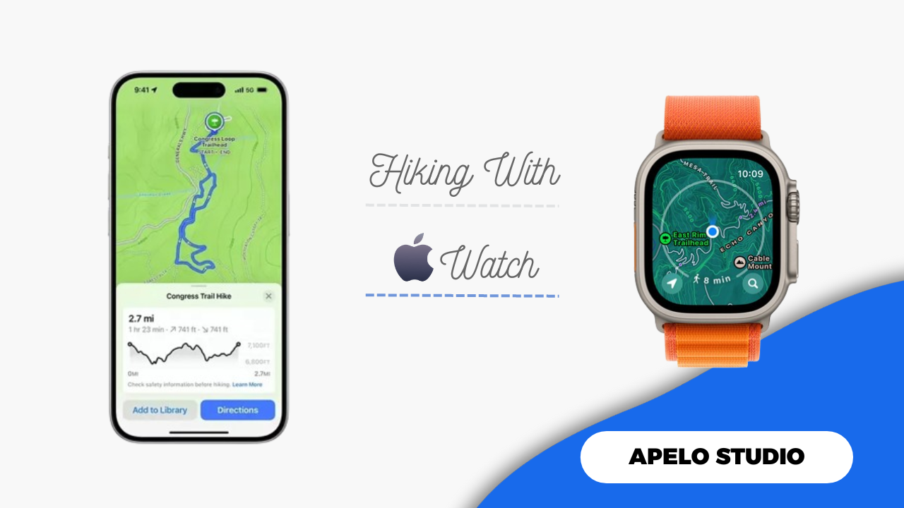
I wear my Apple Watch Series 8 whenever I go hiking, and it’s incredible how it enables me to embrace the great outdoors. I’ve navigated dozens of trails, gone to places I didn’t know even existed, recorded my progress, and stayed safe in every hiking adventure thanks to the features built into watchOS 10.
The watchOS 10 has a plethora of impressive features great for hikers. There’s the Hiking workout profile, the compass app for waypoints and backtrack, improved topographic maps, marked location points and what’s walkable, reliable GPS connectivity, and fall detection for safety.
And if you would rather use third-party apps instead to take your hiking experience to the next level, get Gaia, Komoot, or PeakVisor, especially because each app offers live GPS route tracking.
Hiking Workout Profile
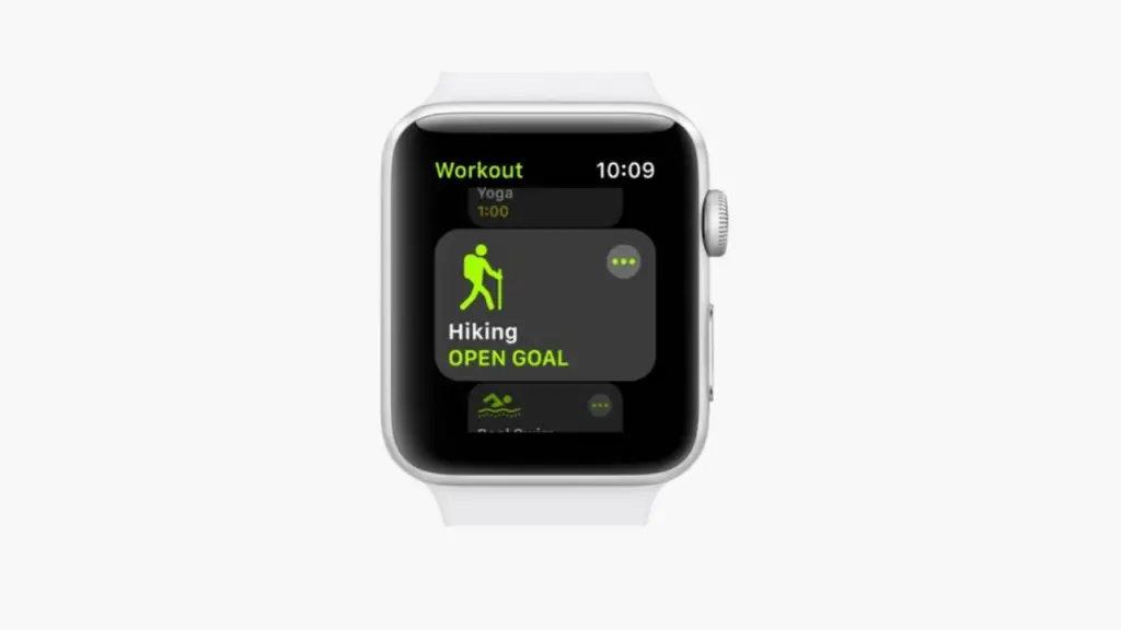
The Hiking workout profile on Apple Watch is the first place to start when you’re set to explore the great outdoors.
- Open the Workout app on your Apple Watch.
- Choose Hiking.
- Leave the workout to Open Goal or tap the three dots on the top right of the screen to customize your hiking stats, such as calories, distance, and time.
- Tap the workout to start recording.
- Swipe the screen to the right to end the workout.
Once you end the workout, you’ll see the distance you’ve covered, elevation you’ve climbed, calories you’ve burned, the route you’ve walked, the total time you’ve spent hiking, and your heart rate.
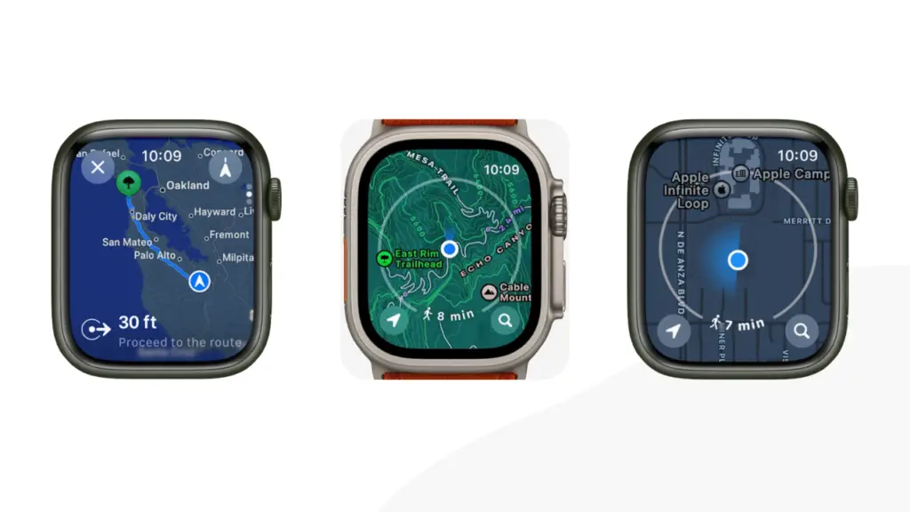
The Compass App

Waypoints and backtrack are two important compass app features ideal for hikers.
- Waypoints: The compass app tags the last location where you had cell service and the last location where you can make an emergency call via any carrier. And the waypoints will update upon the detection of new signals along your hiking trail.
- Backtrack: The purpose of backtrack on your Apple Watch is to guide you to either where you began your hiking adventure or to one of the waypoints. Backtrack also helps you discover new places without losing the way to where you started.
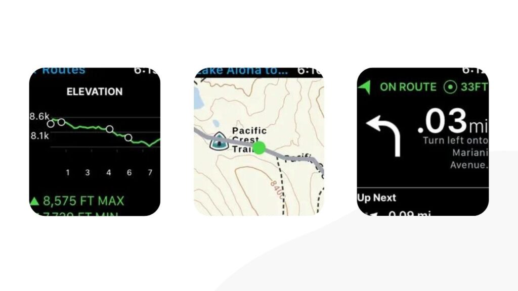
Improved Topographical Maps
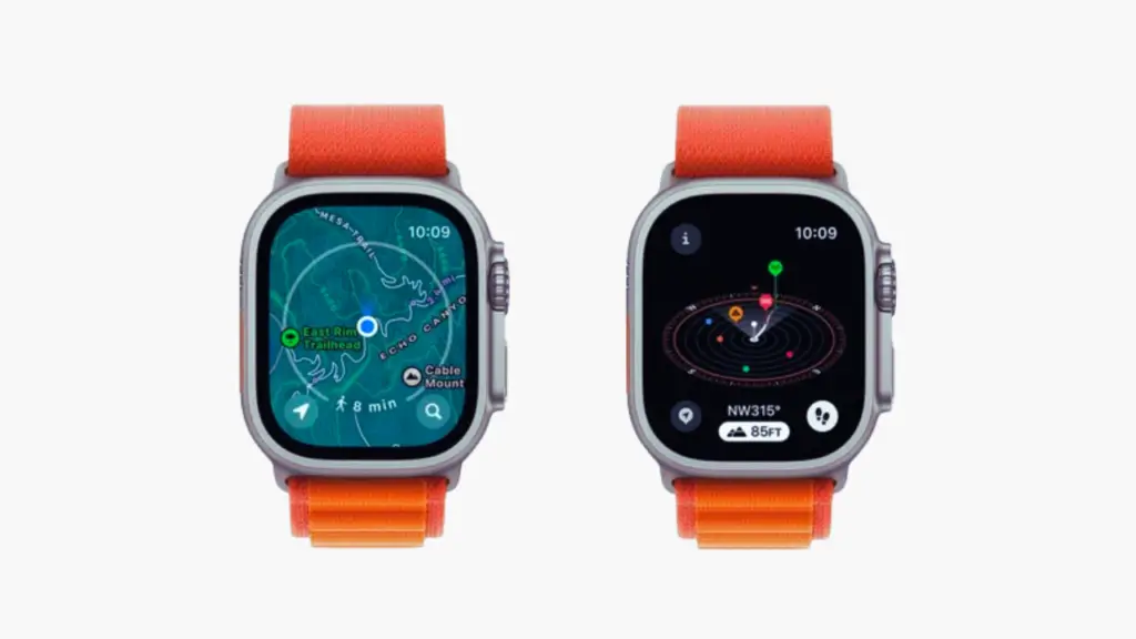
The watchOS 10 update brought improved to topographic maps to the Apple Watch.
The map view includes shadings and contour lines that show change in elevation. And as with regular maps, you can save the topographical maps for offline use, especially in areas with poor network access.
Marked Location Points and What’s Walkable
Marked location points and the “What’s Walkable” are additional features that came to Maps on Apple Watch with watchOS 10 updates, and they’re helpful for outdoor adventures.
The marked location points show you the starting point of notable landmarks, which you can access by foot. Because the trails include names, user-generated photos, and length hikes, you can determine whether a route is worth hiking based on its elevation.
While the What’s Walking feature is mostly ideal for urban hikers, it might help you to find points of interest even in otherwise insanely remote hiking trails. When What’s Walking is active, a circle appears on the Map’s interface with landmark markings and travel time for each.
Reliable GPS and Cellular Connectivity
Built into my Apple Watch Series 8 is the multi-band and multi-GNSS positioning for reliable GPS connectivity. This Global Navigation Satellite System incorporates L1 GPS, GLONASS, Galileo, QZSS, and BeiDou, making the smartwatch ideal for easy navigation even in challenging backpacking and hiking environments.
There’s no way to customize these GPS services, you can’t adjust your recording intervals, and you can’t turn off any of the bands. In some instances, your Apple Watch may use Wi-Fi, cellular towers,and Bluetooth technology to position you.
Safety on Hiking Trail

Fall detection is one the safety features built into the Apple Watch. And while you never go hiking or backpacking expecting an imminent danger, it’s important to enable this safety feature just in case.
The way automatic fall detection works on Apple Watch is it taps your wrist, sounds an alarm, and shows a notification if it detects a hard fall that it believes is catastrophic. You can then call emergency, dismiss the alert, or tap “I’m OK”.
Ideally, the fall detection feature is especially useful if you go hiking and backpacking alone.
Best Third-Party Hiking Apps for Apple Watch
There are many third-party apps for hiking on Apple Watch and iPhone. However, the ones I highly recommend are Gaia GPS, Komoot, and PeakVisor.
Gaia GPS
Download and use Gaia GPS if you’re a confident adventure seeker with interest in hiking, overlanding, and hiking.
Gaia GPS features route planners, offline maps, and distance trackers, which are important tools that give you the best possible navigation experience as you explore the great outdoors.
You can leave breadcrumbs on the map by marking hiking trails, routes, water resources, and campgrounds as you hike or backpack. Gaia GPS will use this information to help you find your way back to points of interest the next time you go hiking to the same trail.
Gaia GPS offers weather predictions, which helps you to stay ahead of changing conditions, so you can plan your outdoor binge accordingly. And if nightfall approaches and you’re unsure if you’ll make it back home on time, Gaia GPS can help you find a safe and suitable camping site to spend the night.
Komoot
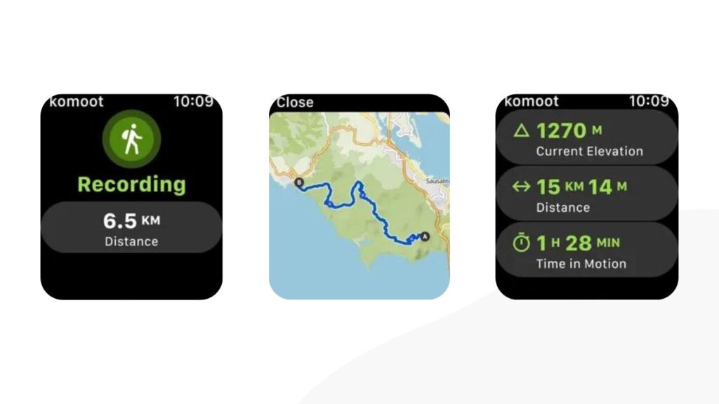
Komoot lets find the perfect trail route before you head out for a hiking adventure.
And once you’ve created a clear plan for the great outdoors, download the topographic maps so you can still navigate the route even when your iPhone and Apple Watch can’t connect to the internet.
The one thing about Komoot that stands out to me is the turn-by-turn voice navigation. It’s so on point you won’t lose your way even in extremely confusing surroundings.
PeakVisor
PeakVisor is a state-of-the-art Apple Watch and iPhone app for mountain explorers.
It features three-dimensional (3D) maps of pathways and hiking trails to follow. Additionally, PeakVisor estimates pathway distances, making it possible for you to estimate the time it would take to reach a certain location.
You might lose internet connection when hiking and backpacking. Here’s where PeakVisor offline maps come to the rescue, allowing you to keep going even when your cellular network has poor coverage.